
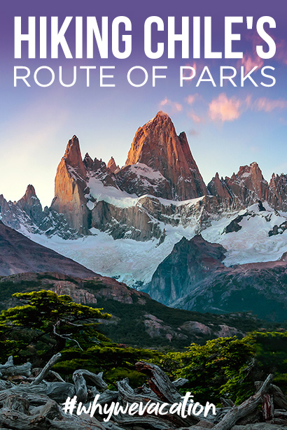
Chile: One Trail to Bind them All
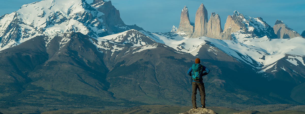
Stretching 1,740 miles from Puerto Montt in Chile’s Lake District to Cape Horn in the Tierra del Fuego archipelago, the Route of Parks spans a third of the entire country. Length alone does not make it epic—but the 17 national parks it connects does. From the waterfalls of Alerce Andino in the north to the fjords of Yendegaia at the southern tip, with volcanoes, rainforests, glaciers and the soaring peaks of the Andes in between—the full spectrum of Chile’s significant wonders are on full display throughout.
Few people will hike the entire Route of Parks. Most will tackle it in sections by car, stopping off at scenic highlights to hike or mountain bike deep into national parks, then return to their luxury hotel at night. Regardless of how you approach the trail, the sights, as well as the friendliness of the Chilean people and the laidback culture of this rising country, will stay with you forever.

Colony of King Penguins at Tierra del Fuego
History Meets Future
A trail of this magnitude does not appear out of thin, high-altitude air. Its roots can be traced back to 1976, when Chilean dictator Augusto Pinochet ordered the construction of a road to reach the unpopulated southern lands of Patagonia. Taking the better part of a decade to construct, the dirt road became known as Carretera Austral, a.k.a. the Southern Highway.
To complete the Route of Parks, though, needed a forward-thinking act. Thankfully, this is where Tompkins Conservation stepped in to make the biggest private land donation in history. Created by the former CEO of Patagonia clothing company Kristine McDivitt Tompkins and her late husband Douglas Tompkins, the founder of North Face, Tompkins Conservation has been safeguarding pristine land in Chile and Argentina to strengthen the original ecosystem and support sustainable tourism.
In March of 2017, the company donated 10 million acres to the Chilean government to create five new national parks and expand three others. The Route of Parks veins through this land, connecting Carretera Austral with other existing trails to take travelers on an unprecedented journey through the most stunning, most remote parts of Chile, connecting 60 communities, 24 distinct ecosystems and the feature parks below along the way.

One of the many glaciers from the South Patagonian Ice Cap
Corcovado National Park
We do not recommend hiking to the top of 7,218-foot Corcovado Volcano, but the view would be astounding. Across the park’s 726,000 acres, you’d spy neighboring volcanoes whitened by thick hats of snow, dense, ancient rainforests carpeting the base of the mighty mountains, and several of the 82 lakes that attract visitors and animals alike.
It’s the animals that you should look for while inside this primordial and biodiverse terrain. Pumas prowl in the shadows of the forests, while small herds of fluffy, llama-like guanacos roam the vast steppe. It’s a different scene at the Bay of Corcovado, where penguins skip from rock to rock and massive colonies of sandpipers and curlews blanket the beach. And since the sapphire blue waters are a vital feeding and nesting sanctuary for migratory blue whales, the sociable behemoths are easy to spot frolicking in the whitecaps near seals and sea lions.

Guanacos herd on the mountainside
Laguna San Rafael
Even though Laguna San Rafael National Park is named after a lagoon, it’s not the liquid water that draws people here. Instead, they come for the 1,600-square-mile Northern Patagonian Ice Field, the massive mother of the area’s numerous rivers and lakes, as well as 28 glaciers, including accessible San Rafael and the 30,000-year-old San Valentín Glaciers. The ice field extends over Mount San Valentín, the highest mountain in the Southern Andes, blanketing the surrounding plains. Such a unique landscape—a designated UNESCO World Biosphere Reserve—creates the ideal stomping grounds for a bevy of enchanting creatures, great and small. Short, stocky Chilean dolphins, mammoth elephant seals and playful sea otters share the sea, while the skies team with black-browed albatrosses and black-necked swans.
Regardless of the wild, icy reception, visitors are welcomed here year-round. Most arrive via sea craft, either a cruise ship or catamaran, transferring to agile inflatables to skitter up close to San Rafael Glacier’s nearly 200-foot-high façade. Drifting around the lagoon, watching the indigo icebergs bob in the water, hearing house-sized chunks of ice sigh, splinter and then crash into the sea with a thunderous roar is truly an unforgettable spectacle.

The striking granite towers of Torres Del Paine
Torres Del Paine
The Route of Parks would not be complete without connecting to Torres del Paine National Park, Patagonia’s soaring gem. In the summer, this tip of the world receives 17 hours of daylight, and you’re going to need them all to soak in the serene teal lakes, towering granite pillars, pounding waterfalls and radiant icebergs that will highlight your visit.
There’s more to Torres del Paine simply than the stunning landscapes. Animal lovers will get their fill, spotting gray foxes in the high plains brush, their eyes keenly lit in search of their next meal; and Andean condors circling overhead, their nine-foot wingspans casting surreal shadows below. Culture seekers delight in the historic Milodón Caves, where the continent’s first humans covered the walls with ancient drawings.
Yet it’s the terrain that is the park’s main draw, especially the namesake Paine Towers. These three, highly photogenic granite spires stand out among the jagged Cordillera Paine Mountains, towering over glacial lakes and snow-spotted pampas. Catching the light at different angles, they start the day as rose-colored beacons at sunrise, slowly turning different shades of blue as the sun slides across the sky, making them a joy to soak in from different viewpoints.
There are many ways to experience the Paine Towers, along with the rest of the park itself. Horseback rides with gauchos, glacier hikes and expert-guided nature walks immerse you in the landscape, as does kayaking right up to the massive icebergs leisurely floating across Grey Lake. For those seeking a complete tour, hiking the celebrated W Trek is a multi-day expedition that unforgettably weaves through the skyscraping mountains, dark blue fjords and hauntingly beautiful woodlands.
We are here to help you turn your travel dreams into reality. contact us today!
Explore more Inspiration Articles

Travel Leaders Network is the largest network of professional travel agents in North America. Wherever you want to go, however you want to get there — we have a travel agent for you.
Using an Agent Enhances Your Overall Travel Experience.
Local Agents. Global Experts.
Our travel agents are respected worldwide by a massive network of cruise, resort and tour companies, giving us special advantages to making your vacation truly unique.
77
Years Serving the Travel Industry
14,528
Travel Experts In the U.S.
65
Industry Awards Since 2009
300
Global Partnerships